Here is the latest information on the severe weather event likely to impact the area. Information source: National Weather Services
March 22 6 a.m. Update
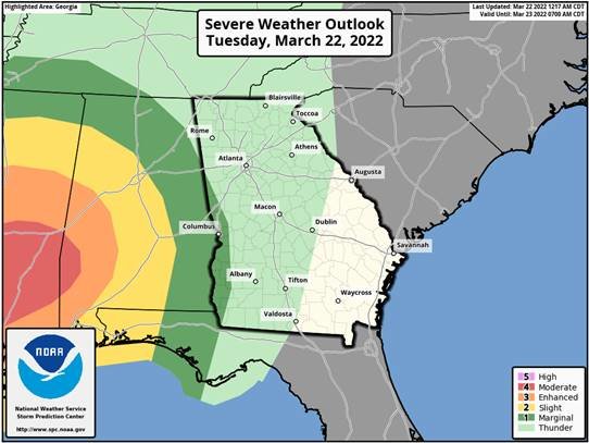
The Marginal Risk area from SPC valid late tonight through 8 AM EDT has shifted a little further east into westcentral Georgia.
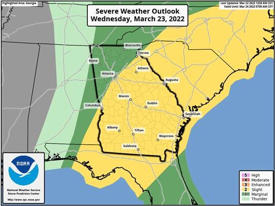
The Slight Risk area valid after 8 AM EDT Wednesday has also shifted a little south and east.
Severe Weather - Wednesday
What: Slight Risk (2 out of 5) for damaging winds, hail, very heavy rain and a brief tornado.
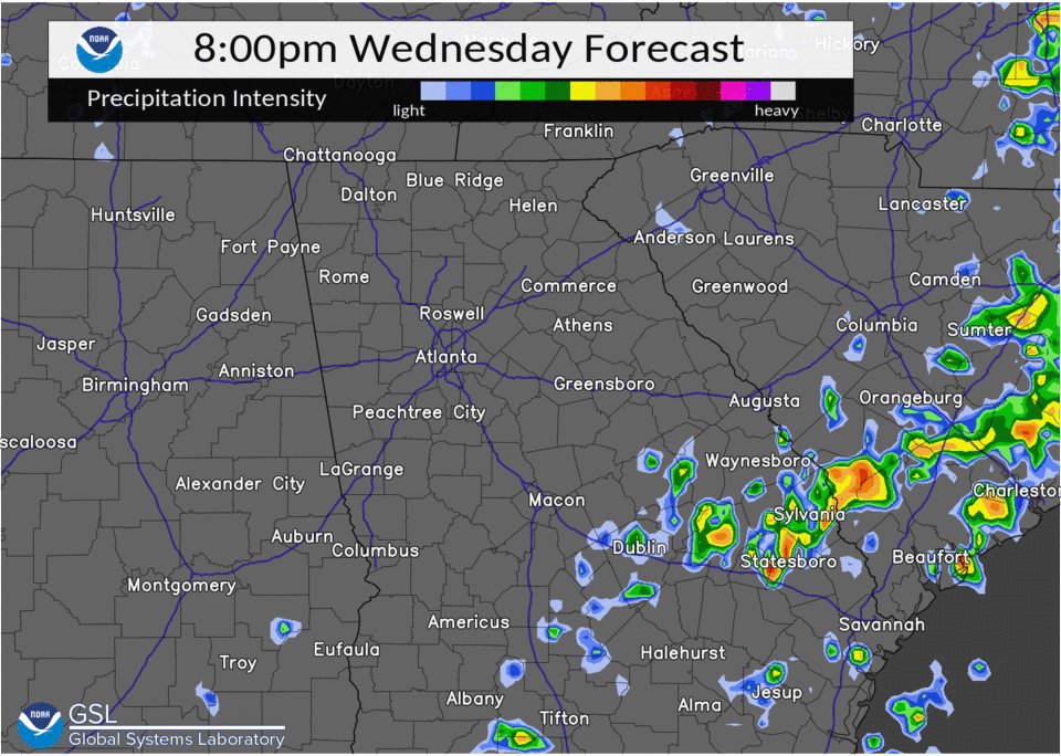
When: Mainly between 3 AM and 8 PM Wednesday (see timing animation below)
Where: All but NW Georgia, mainly south and east of a Columbus to Atlanta to Athens line.
Confidence: 3 out of 5 (Medium)
Basis: Strong to severe thunderstorms in central Alabama are expected to push into westcentral Georgia after 3 AM. While these storms should weaken as the morning continues, isolated areas of damaging winds or a brief tornado could still occur. By midday, the line of storms should redevelop and strengthen as it continues east across middle and eastern Georgia. See the day 1 and day 2 outlook discussion from the Storm Prediction Center for more information.
March 22 9:30 a.m. Update
A cold front is forecast to move through the Southeast on Wednesday, bringing another chance for severe thunderstorms across Georgia. The Storm Prediction Center has much of Georgia under a Slight Risk (level 2 of 5) for damaging winds and a couple of tornadoes in any severe storms that develop between Wednesday morning and Wednesday evening.
Scattered showers will move into Georgia before sunrise on Wednesday and overspread much of Georgia by midday. Some thunderstorms embedded within a broken line could become strong to severe during the late morning through the afternoon, particularly south of the I-85 corridor. Thunderstorm activity should start to diminish later in the evening.
Models are showing another surge of Gulf moisture moving through southern and eastern Georgia overnight into Thursday. A few strong to severe thunderstorms could develop over Southeast Georgia on Thursday as the cold front slowly moves off the coast. After the gradual clearing on Thursday and Friday, sunny and mild weather is in store through early next week across Georgia.
Note: this is just one model depiction of what may happen. Do not rely on this forecast for exact timing.